#geography_of_ireland
Geography of Ireland
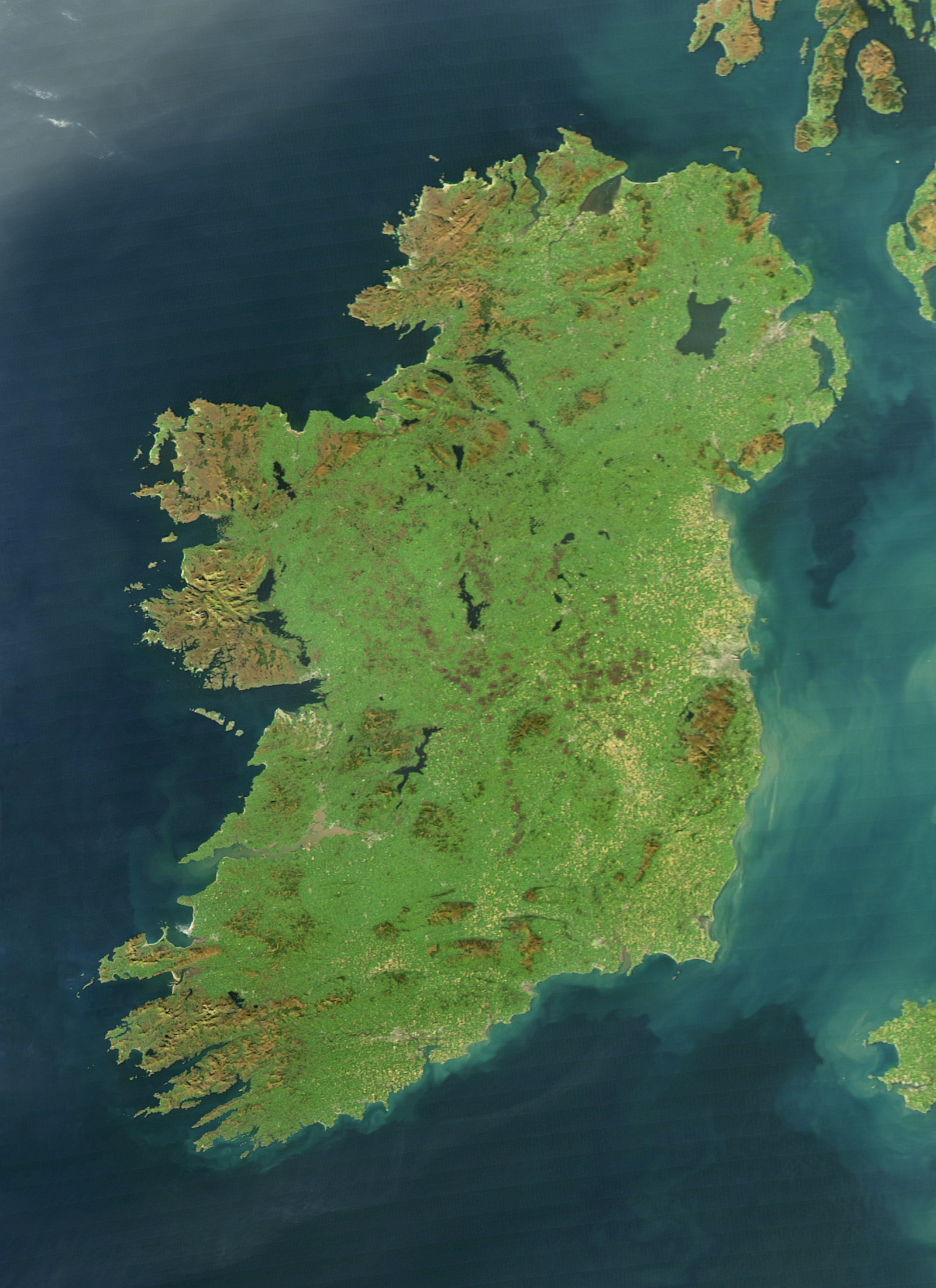
Ireland is an island in Northern Europe in the north Atlantic Ocean. The island, of up to around 480 km (300 mi) north-south, and 275 km (171 mi) east-west, lies near the western edge of the European continental shelf, part of the Eurasian Plate. Its main geographical features include low central plains surrounded by coastal mountains. The highest peak is Carrauntoohil, which is 1,039 metres (3,409 ft) above sea level. The western coastline is rugged, with many islands, peninsulas, headlands and bays, while the southern and northern coasts feature a smaller number of substantial sea inlets, such as Lough Foyle and Cork Harbour; no part of the land is more than around 110 km (68 mi) from the sea. It was administratively divided into 32 counties, gathered in 4 provinces, though current arrangements, especially in Northern Ireland, differ from this model. The island is almost bisected by the River Shannon, which at 360.5 km (224 mi) with a 102.1 km (63 mi) estuary is the longest river in Ireland and flows south from County Cavan in the province of Ulster to form the boundary between Connacht and Leinster, and later Munster, and meet the Atlantic just south and west of Limerick. There are a number of sizeable lakes along Ireland's rivers, of which Lough Neagh is the largest.
Sun 15th
Provided by Wikipedia
This keyword could refer to multiple things. Here are some suggestions: