#halaib_triangle
Halaib Triangle
Disputed territory between Egypt and Sudan
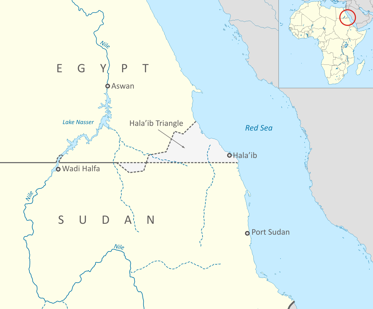
The Halaib Triangle is an area of land measuring 20,580 square kilometres (7,950 sq mi) located on the Northeast African coast of the Red Sea. The area, which takes its name from the town of Halaib, is created by the difference in the Egypt–Sudan border between the "political boundary" set in 1899 by the Anglo-Egyptian Condominium, which runs along the 22nd parallel north, and the "administrative boundary" set by the British in 1902, which gave administrative responsibility for an area of land north of the line to Sudan, which was an Anglo-Egyptian client at the time. With the independence of Sudan in 1956, both Egypt and Sudan claimed sovereignty over the area. The area has been considered to be a part of the Sudan's Red Sea State, and was included in local elections until the late 1980s. In 1994, the Egyptian military moved to take control of the area as a part of Red Sea Governorate, and Egypt has been actively investing in it since then. Egypt has been recently categorical in rejecting international arbitration or even political negotiations regarding the area.
Sat 31st
Provided by Wikipedia
This keyword could refer to multiple things. Here are some suggestions: