#satellite_temperature_measurement
Satellite temperature measurement
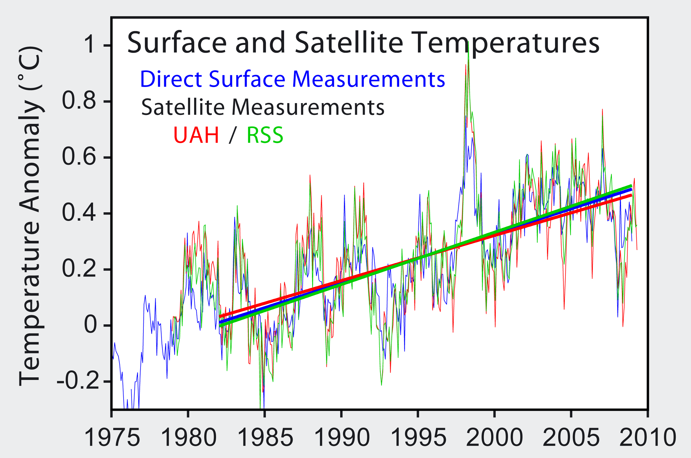
Measurements of atmospheric, land surface or sea temperature by satellites.
Satellite temperature measurements are inferences of the temperature of the atmosphere at various altitudes as well as sea and land surface temperatures obtained from radiometric measurements by satellites. These measurements can be used to locate weather fronts, monitor the El Niño-Southern Oscillation, determine the strength of tropical cyclones, study urban heat islands and monitor the global climate. Wildfires, volcanos, and industrial hot spots can also be found via thermal imaging from weather satellites.
Wed 22nd
Provided by Wikipedia
This keyword could refer to multiple things. Here are some suggestions: